
Bonn
Kennedybrücke, 53 Bonn, Deutschland
Kennedy Bridge | Route & Closure Bonn
The Kennedy Bridge is one of the defining traffic and urban spaces in Bonn and serves as a central point of orientation on the Rhine for many inquiries regarding route, maps, closures, and webcams. When people search for the bridge, they often mean not just a structure, but an important connection between Bonn city center and Beuel, a significant crossing along the B56, and a place where urban life, traffic, and views of the Rhine come together directly. For this reason, the Kennedy Bridge in Bonn is not a casual infrastructure element but a daily part of the route for cars, trams, cyclists, and pedestrians. Its history dates back far, but its current form primarily represents the connection between two sides of the city that are historically, architecturally, and traffic-wise closely related. For visitors, commuters, and anyone searching for Kennedy Bridge Bonn closed, Kennedy Bridge Bonn route, or Kennedy Bridge Bonn maps, it is especially important: Here, not only does a road end, but a central section of Bonn's mobility begins. The official city history, bridge statics, and current traffic information together show why the Kennedy Bridge remains one of the most important Rhine crossings in the city to this day. ([bonn.de](https://www.bonn.de/medien-global/amt-61/Tag_des_offenen_Denkmals_2018_2.pdf))
Where is the Kennedy Bridge in Bonn and what does it connect?
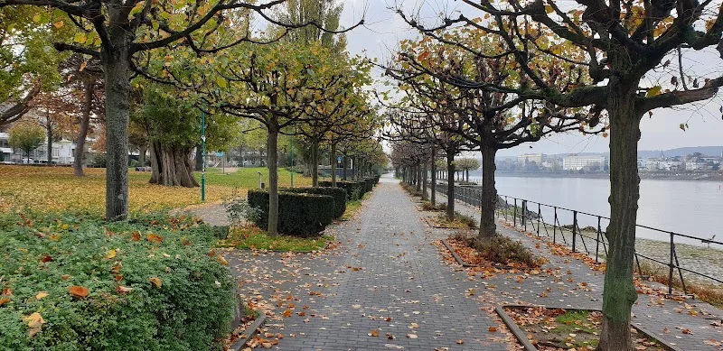
The Kennedy Bridge is located in the heart of Bonn and connects the Bonn city center with the right bank district of Beuel. It is the middle of the three Bonn Rhine bridges and spans the river along Federal Highway 56. Thus, it is not just a bridge but a clearly defined city entrance that links the left bank center with the other side of the Rhine. The bridge carries the lanes of the B56, two tram tracks, as well as pedestrian and cycling paths, allowing multiple modes of transport to converge in a tight space. This is precisely what makes the location so relevant for anyone wanting to find out about Kennedy Bridge Bonn route, Kennedy Bridge Bonn maps, or Kennedy Bridge Bonn trucks: The bridge is part of a larger axis and not an isolated crossing. Its character is therefore double-layered. On one hand, it is a functional Rhine crossing for everyday traffic; on the other hand, it is an urban space with views of the opera, the Rhine, the city center, and the eastern bank of the Rhine. The Kennedy Bridge is also the only inner-city Rhine bridge in Bonn, which particularly enhances its significance in the traffic system. While other bridges mainly support regional or supra-regional traffic flow, the Kennedy Bridge consolidates routes directly in the heart of the city. This also explains why traffic disruptions or closures are immediately noticeable here and why inquiries about Kennedy Bridge Bonn closed occur so frequently. To understand Bonn, one must see the Kennedy Bridge as a link between two sides of the city, as part of the B56, and as a permanently important axis for mobility, accessibility, and urban experience. ([structurae.net](https://structurae.net/de/bauwerke/kennedybruecke))
History of the Kennedy Bridge: from the old Rhine Bridge to the current name
The current Kennedy Bridge stands on a historical foundation. As early as the 17th century, the connection between Bonn and Beuel was not only a geographical but also an everyday topic, initially with boats and later with ferries. The first Bonn Rhine Bridge was built between 1896 and 1898, connecting the present-day districts of Beuel and the city center. This structure was destroyed shortly before the end of the war in 1945. Subsequently, in 1948/49, the current Rhine Bridge was built on the pillars of the old bridge, which once again connected the two banks and became a strong symbol of reconnection for the post-war period. Since autumn 1963, the bridge has been named Kennedy Bridge, after the US President John F. Kennedy, who was assassinated in the same year. In the city's history, it is thus visible not only as a traffic object but also as a place of remembrance. For the Kennedy Bridge Bonn closed search, this past is important because the bridge has been closely associated with renovations, repairs, and adjustments to the growing city traffic from the very beginning. Its later widening is also part of the bridge's history: from 2007 to 2010, it was extensively renovated and widened from 18 meters to 26.80 meters. A look at history shows that the Kennedy Bridge was never static. It has continually been adapted to new traffic needs while remaining a defining Bonn landmark. This mixture of historical continuity and technical renewal is what gives it its special charm. Today, anyone driving, walking, or taking the tram over the bridge is moving over a structure that connects several epochs of the city. ([bonn.de](https://www.bonn.de/medien-global/amt-61/Tag_des_offenen_Denkmals_2018_2.pdf))
Route and Maps: How to approach via the B56
The most practical orientation to the Kennedy Bridge begins with Federal Highway 56. The bridge is located directly along this important traffic axis and is therefore very easy to identify on maps, navigation systems, and traffic guides. Those coming from Bonn city center are heading towards the Rhine crossing, while on the Beuel side, the connection to local traffic is immediately continued. In connection with current traffic information from the city of Bonn, it becomes clear that the area around Kennedy Bridge, Konrad-Adenauer-Platz, and the adjacent streets is a tightly interwoven traffic hub. Therefore, inquiries such as Kennedy Bridge Bonn route and Kennedy Bridge Bonn maps are particularly sensible: Those wanting to go to the bridge usually want to find not just the point itself but also the appropriate access, the best detour, and the correct connection to the city center or Beuel. For everyday life, it is important that the bridge serves as a central east-west axis used simultaneously by cars, trams, cyclists, and pedestrians. This makes route planning here somewhat more sensitive than on an ordinary city street. The city of Bonn regularly publishes traffic information during major events and construction projects, explicitly mentioning the area of the Kennedy Bridge. This makes the bridge a fixed reference point for diversions, temporary closures, and alternative routes. Therefore, anyone planning a route should not only understand the bridge as a point on the map but as part of a larger urban traffic space. The best route is therefore not always the shortest but the one that takes current traffic, possible closures, and the desired mode of transport into account. For visitors, this means: check maps, pay attention to traffic conditions, and think of the Rhine crossing as a dynamic, not a static place. ([trid.trb.org](https://trid.trb.org/View/1102563))
Parking around the Kennedy Bridge: City Center, Beuel, and Park & Ride
Those driving to the Kennedy Bridge should not plan parking spontaneously but utilize the city's parking structure. The city of Bonn points to a city-wide parking strategy and provides a map of parking garages, parking spaces, and the nearest Park & Ride offerings. In Bonn city center, around 4,500 parking spaces are available in parking garages, and there are numerous other parking options in Beuel, Bad Godesberg, and Hardtberg. For visitors to the Kennedy Bridge, it is especially important that the Park & Ride facilities offer a stress-free alternative, as they are usually located close to public transport stops, thus facilitating the switch from car to bus or train. Overall, there are nine Park & Ride facilities in Bonn with a total of 850 spaces. Notably highlighted are Vilich, Ramersdorf, the Bad Godesberg station, Rigal'sche Wiese, and Duisdorf. Two larger parking garages, Museumsmeile with 535 spaces and Karl-Carstens-Straße with 970 spaces, are located on the edge of the city center and are reportedly used less frequently according to the city, but they provide a good alternative, especially on heavily frequented days. For the Kennedy Bridge, this means: Directly at the bridge, parking is usually not like at an event location, but one utilizes the surrounding urban parking infrastructure or resorts to Park & Ride. This is particularly sensible when closures, events, or high occupancy affect city center traffic. The search for Kennedy Bridge Bonn maps or Kennedy Bridge Bonn route is therefore closely linked to the question of parking. Depending on the destination on the Bonn or Beuel side, a parking garage on one side and a footpath over the bridge can be the much quicker solution. For a relaxed visit, it is worthwhile to consciously leave the car outside the immediate bridge area and cover the last stretch flexibly on foot or by train. ([bonn.de](https://www.bonn.de/themen-entdecken/verkehr-mobilitaet/Autos-parken-in-Bonn.php?loc=es))
Closures, Traffic, and Trucks: What You Should Consider Before Driving
The Kennedy Bridge is so important in Bonn's traffic that closures have immediate noticeable effects. This is shown not only by construction measures from the past but also by the city's traffic information during major events. During the Deutsche Post Marathon 2024, the area around the Kennedy Bridge in Beuel was explicitly mentioned, and the Kennedy Bridge itself was completely closed during the event. At the same time, the city pointed out other affected areas, parking bans, and the closure of individual parking garages. Such information is relevant for anyone searching for Kennedy Bridge closed or Kennedy Bridge Bonn closure, as it shows: The bridge is not a place with permanently unchanged traffic management but a hub that is specifically regulated during events, construction work, or temporary interventions. Even during the major widening and renovation from 2007 to 2010, the tram and road traffic had to be maintained during the work because the Kennedy Bridge is the only inner-city Rhine bridge in Bonn. This underscores its special status in the network and explains why diversions must be planned particularly carefully here. The same principle applies to truck traffic as for all other vehicles: The bridge is a regular part of the B56, but current traffic information is crucial when construction sites or closures are in the area. Those driving heavy vehicles should check in advance whether there are restrictions for the relevant period. For everyone else: During major events, it is better to divert early, consider alternative Rhine crossings, and choose public transport or bicycles if in doubt. The Kennedy Bridge is normally an open, heavily used traffic area; for this reason, temporary closures can be particularly effective. Understanding the situation allows for a more relaxed drive. ([bonn.de](https://www.bonn.de/pressemitteilungen/april-2024/Verkehrsinfos-und-Service-Hotlines-zum-Deutsche-Post-Marathon.php?loc=en))
Kennedy Bridge Webcam and Rhine View: How to See the Situation Live
There is also a live view of the Kennedy Bridge online, which explains the search for Kennedy Bridge webcam. An HD live webcam in Bonn-Beuel is located on the roof of the homeowners' association on Rheinaustraße and pans over the Rhine from the Kennedy Bridge to the Beethovenhalle. The view looks west towards the center of the federal city of Bonn. In the livestream, the towers of the Bonn Minster, the Dorint Hotel Bonn, the Beethovenhalle, and the landing stage of the Rhine Princess are clearly visible. For anyone wanting to get an idea before arriving, this is practical: One can see the current situation on the Rhine, the effect of the light, the traffic situation on the bridge, and the spatial integration into the city center. The webcam is thus not just a toy for the curious but a useful tool for planning and orientation. Those wanting to know how the Kennedy Bridge functions in everyday life can see the dynamics between the river, city, and traffic particularly clearly here. At the same time, the webcam view helps to recognize closures or increased occupancy before one sets off. The Rhine location in Bonn is generally impressive, but at the Kennedy Bridge, it is particularly intense because the transition between the two banks is so immediate. This is exactly why the bridge remains photographically and digitally interesting: It is a bridge, traffic area, and viewpoint at the same time. Therefore, if one wants to understand the Kennedy Bridge not just as a point on the map but as a vibrant urban space, the live view is a very good entry point. It shows how closely Bonn is connected to the Rhine at this point and how strongly infrastructure and urban experience merge. ([wetter.com](https://www.wetter.com/hd-live-webcams/deutschland/bonn-kennedybruecke/534d43b0bb260/))
Sources:
Show moreShow less
Kennedy Bridge | Route & Closure Bonn
The Kennedy Bridge is one of the defining traffic and urban spaces in Bonn and serves as a central point of orientation on the Rhine for many inquiries regarding route, maps, closures, and webcams. When people search for the bridge, they often mean not just a structure, but an important connection between Bonn city center and Beuel, a significant crossing along the B56, and a place where urban life, traffic, and views of the Rhine come together directly. For this reason, the Kennedy Bridge in Bonn is not a casual infrastructure element but a daily part of the route for cars, trams, cyclists, and pedestrians. Its history dates back far, but its current form primarily represents the connection between two sides of the city that are historically, architecturally, and traffic-wise closely related. For visitors, commuters, and anyone searching for Kennedy Bridge Bonn closed, Kennedy Bridge Bonn route, or Kennedy Bridge Bonn maps, it is especially important: Here, not only does a road end, but a central section of Bonn's mobility begins. The official city history, bridge statics, and current traffic information together show why the Kennedy Bridge remains one of the most important Rhine crossings in the city to this day. ([bonn.de](https://www.bonn.de/medien-global/amt-61/Tag_des_offenen_Denkmals_2018_2.pdf))
Where is the Kennedy Bridge in Bonn and what does it connect?
The Kennedy Bridge is located in the heart of Bonn and connects the Bonn city center with the right bank district of Beuel. It is the middle of the three Bonn Rhine bridges and spans the river along Federal Highway 56. Thus, it is not just a bridge but a clearly defined city entrance that links the left bank center with the other side of the Rhine. The bridge carries the lanes of the B56, two tram tracks, as well as pedestrian and cycling paths, allowing multiple modes of transport to converge in a tight space. This is precisely what makes the location so relevant for anyone wanting to find out about Kennedy Bridge Bonn route, Kennedy Bridge Bonn maps, or Kennedy Bridge Bonn trucks: The bridge is part of a larger axis and not an isolated crossing. Its character is therefore double-layered. On one hand, it is a functional Rhine crossing for everyday traffic; on the other hand, it is an urban space with views of the opera, the Rhine, the city center, and the eastern bank of the Rhine. The Kennedy Bridge is also the only inner-city Rhine bridge in Bonn, which particularly enhances its significance in the traffic system. While other bridges mainly support regional or supra-regional traffic flow, the Kennedy Bridge consolidates routes directly in the heart of the city. This also explains why traffic disruptions or closures are immediately noticeable here and why inquiries about Kennedy Bridge Bonn closed occur so frequently. To understand Bonn, one must see the Kennedy Bridge as a link between two sides of the city, as part of the B56, and as a permanently important axis for mobility, accessibility, and urban experience. ([structurae.net](https://structurae.net/de/bauwerke/kennedybruecke))
History of the Kennedy Bridge: from the old Rhine Bridge to the current name
The current Kennedy Bridge stands on a historical foundation. As early as the 17th century, the connection between Bonn and Beuel was not only a geographical but also an everyday topic, initially with boats and later with ferries. The first Bonn Rhine Bridge was built between 1896 and 1898, connecting the present-day districts of Beuel and the city center. This structure was destroyed shortly before the end of the war in 1945. Subsequently, in 1948/49, the current Rhine Bridge was built on the pillars of the old bridge, which once again connected the two banks and became a strong symbol of reconnection for the post-war period. Since autumn 1963, the bridge has been named Kennedy Bridge, after the US President John F. Kennedy, who was assassinated in the same year. In the city's history, it is thus visible not only as a traffic object but also as a place of remembrance. For the Kennedy Bridge Bonn closed search, this past is important because the bridge has been closely associated with renovations, repairs, and adjustments to the growing city traffic from the very beginning. Its later widening is also part of the bridge's history: from 2007 to 2010, it was extensively renovated and widened from 18 meters to 26.80 meters. A look at history shows that the Kennedy Bridge was never static. It has continually been adapted to new traffic needs while remaining a defining Bonn landmark. This mixture of historical continuity and technical renewal is what gives it its special charm. Today, anyone driving, walking, or taking the tram over the bridge is moving over a structure that connects several epochs of the city. ([bonn.de](https://www.bonn.de/medien-global/amt-61/Tag_des_offenen_Denkmals_2018_2.pdf))
Route and Maps: How to approach via the B56
The most practical orientation to the Kennedy Bridge begins with Federal Highway 56. The bridge is located directly along this important traffic axis and is therefore very easy to identify on maps, navigation systems, and traffic guides. Those coming from Bonn city center are heading towards the Rhine crossing, while on the Beuel side, the connection to local traffic is immediately continued. In connection with current traffic information from the city of Bonn, it becomes clear that the area around Kennedy Bridge, Konrad-Adenauer-Platz, and the adjacent streets is a tightly interwoven traffic hub. Therefore, inquiries such as Kennedy Bridge Bonn route and Kennedy Bridge Bonn maps are particularly sensible: Those wanting to go to the bridge usually want to find not just the point itself but also the appropriate access, the best detour, and the correct connection to the city center or Beuel. For everyday life, it is important that the bridge serves as a central east-west axis used simultaneously by cars, trams, cyclists, and pedestrians. This makes route planning here somewhat more sensitive than on an ordinary city street. The city of Bonn regularly publishes traffic information during major events and construction projects, explicitly mentioning the area of the Kennedy Bridge. This makes the bridge a fixed reference point for diversions, temporary closures, and alternative routes. Therefore, anyone planning a route should not only understand the bridge as a point on the map but as part of a larger urban traffic space. The best route is therefore not always the shortest but the one that takes current traffic, possible closures, and the desired mode of transport into account. For visitors, this means: check maps, pay attention to traffic conditions, and think of the Rhine crossing as a dynamic, not a static place. ([trid.trb.org](https://trid.trb.org/View/1102563))
Parking around the Kennedy Bridge: City Center, Beuel, and Park & Ride
Those driving to the Kennedy Bridge should not plan parking spontaneously but utilize the city's parking structure. The city of Bonn points to a city-wide parking strategy and provides a map of parking garages, parking spaces, and the nearest Park & Ride offerings. In Bonn city center, around 4,500 parking spaces are available in parking garages, and there are numerous other parking options in Beuel, Bad Godesberg, and Hardtberg. For visitors to the Kennedy Bridge, it is especially important that the Park & Ride facilities offer a stress-free alternative, as they are usually located close to public transport stops, thus facilitating the switch from car to bus or train. Overall, there are nine Park & Ride facilities in Bonn with a total of 850 spaces. Notably highlighted are Vilich, Ramersdorf, the Bad Godesberg station, Rigal'sche Wiese, and Duisdorf. Two larger parking garages, Museumsmeile with 535 spaces and Karl-Carstens-Straße with 970 spaces, are located on the edge of the city center and are reportedly used less frequently according to the city, but they provide a good alternative, especially on heavily frequented days. For the Kennedy Bridge, this means: Directly at the bridge, parking is usually not like at an event location, but one utilizes the surrounding urban parking infrastructure or resorts to Park & Ride. This is particularly sensible when closures, events, or high occupancy affect city center traffic. The search for Kennedy Bridge Bonn maps or Kennedy Bridge Bonn route is therefore closely linked to the question of parking. Depending on the destination on the Bonn or Beuel side, a parking garage on one side and a footpath over the bridge can be the much quicker solution. For a relaxed visit, it is worthwhile to consciously leave the car outside the immediate bridge area and cover the last stretch flexibly on foot or by train. ([bonn.de](https://www.bonn.de/themen-entdecken/verkehr-mobilitaet/Autos-parken-in-Bonn.php?loc=es))
Closures, Traffic, and Trucks: What You Should Consider Before Driving
The Kennedy Bridge is so important in Bonn's traffic that closures have immediate noticeable effects. This is shown not only by construction measures from the past but also by the city's traffic information during major events. During the Deutsche Post Marathon 2024, the area around the Kennedy Bridge in Beuel was explicitly mentioned, and the Kennedy Bridge itself was completely closed during the event. At the same time, the city pointed out other affected areas, parking bans, and the closure of individual parking garages. Such information is relevant for anyone searching for Kennedy Bridge closed or Kennedy Bridge Bonn closure, as it shows: The bridge is not a place with permanently unchanged traffic management but a hub that is specifically regulated during events, construction work, or temporary interventions. Even during the major widening and renovation from 2007 to 2010, the tram and road traffic had to be maintained during the work because the Kennedy Bridge is the only inner-city Rhine bridge in Bonn. This underscores its special status in the network and explains why diversions must be planned particularly carefully here. The same principle applies to truck traffic as for all other vehicles: The bridge is a regular part of the B56, but current traffic information is crucial when construction sites or closures are in the area. Those driving heavy vehicles should check in advance whether there are restrictions for the relevant period. For everyone else: During major events, it is better to divert early, consider alternative Rhine crossings, and choose public transport or bicycles if in doubt. The Kennedy Bridge is normally an open, heavily used traffic area; for this reason, temporary closures can be particularly effective. Understanding the situation allows for a more relaxed drive. ([bonn.de](https://www.bonn.de/pressemitteilungen/april-2024/Verkehrsinfos-und-Service-Hotlines-zum-Deutsche-Post-Marathon.php?loc=en))
Kennedy Bridge Webcam and Rhine View: How to See the Situation Live
There is also a live view of the Kennedy Bridge online, which explains the search for Kennedy Bridge webcam. An HD live webcam in Bonn-Beuel is located on the roof of the homeowners' association on Rheinaustraße and pans over the Rhine from the Kennedy Bridge to the Beethovenhalle. The view looks west towards the center of the federal city of Bonn. In the livestream, the towers of the Bonn Minster, the Dorint Hotel Bonn, the Beethovenhalle, and the landing stage of the Rhine Princess are clearly visible. For anyone wanting to get an idea before arriving, this is practical: One can see the current situation on the Rhine, the effect of the light, the traffic situation on the bridge, and the spatial integration into the city center. The webcam is thus not just a toy for the curious but a useful tool for planning and orientation. Those wanting to know how the Kennedy Bridge functions in everyday life can see the dynamics between the river, city, and traffic particularly clearly here. At the same time, the webcam view helps to recognize closures or increased occupancy before one sets off. The Rhine location in Bonn is generally impressive, but at the Kennedy Bridge, it is particularly intense because the transition between the two banks is so immediate. This is exactly why the bridge remains photographically and digitally interesting: It is a bridge, traffic area, and viewpoint at the same time. Therefore, if one wants to understand the Kennedy Bridge not just as a point on the map but as a vibrant urban space, the live view is a very good entry point. It shows how closely Bonn is connected to the Rhine at this point and how strongly infrastructure and urban experience merge. ([wetter.com](https://www.wetter.com/hd-live-webcams/deutschland/bonn-kennedybruecke/534d43b0bb260/))
Sources:
Frequently Asked Questions
Reviews
No reviews found